Boardwalk of Time
Conservation Masterplan for Ashdod
The conservation elements, the cultural assets, the connection between nature and culture and the understanding of the "Ashdodian" identity should be seen as a lever for sustainable development in the city. In Ashdod, these properties are of historical and archaeological value that combine culture and nature, along with the architecture and the urban fabric created over the years of the state.
The 'green ring' surrounds the city of Ashdod and combines cultural assets that include the sea, the Lakish stream, the Kurkar ridges and the sands.
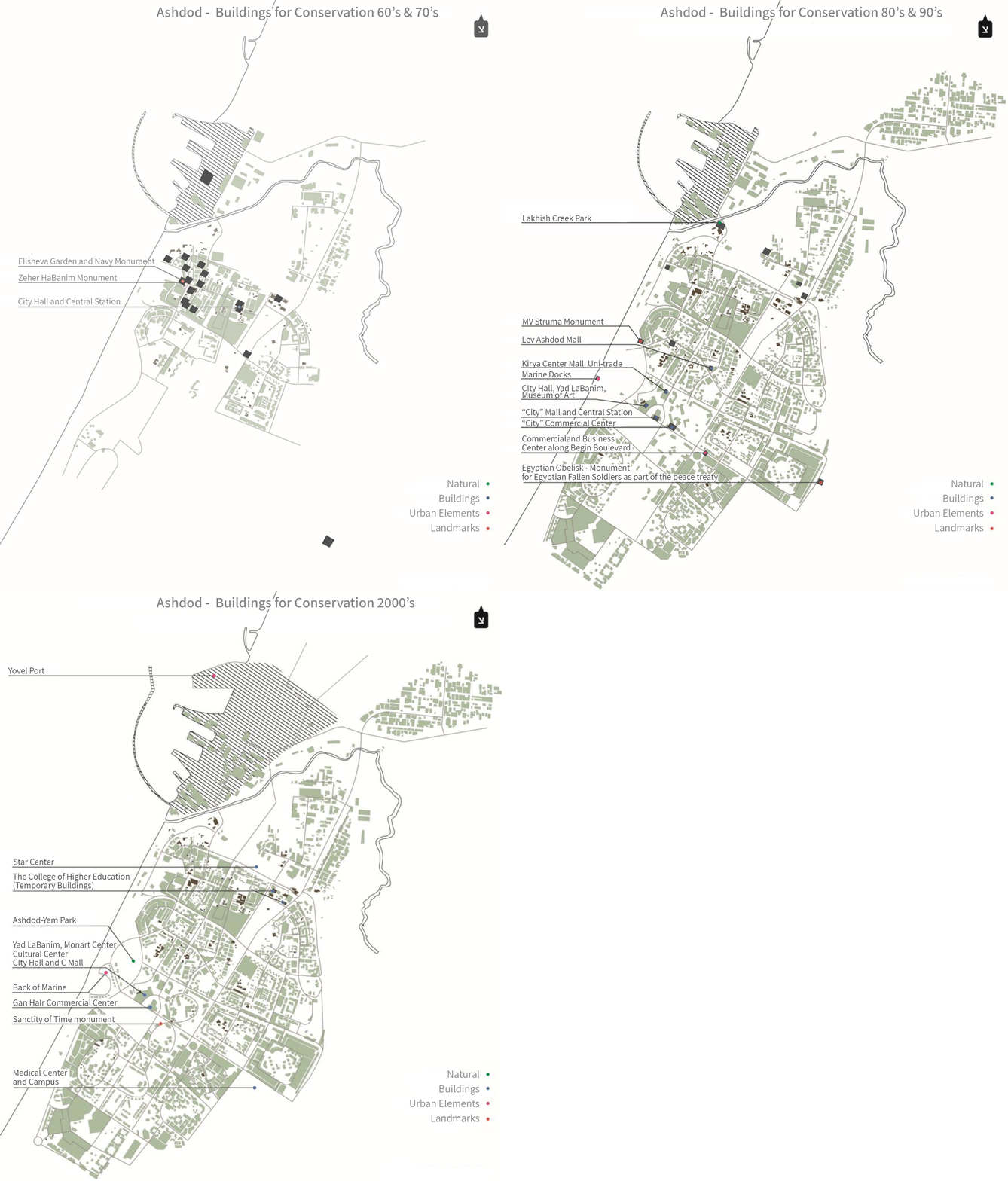
There are two conservation systems - the first is historical-archaeological and the second is Israeli-modern, including the buildings of the district and the buildings.Archaeological historical systemThe system includes three components - the Lakish creek area, the Central area and the Ashdod-Yam area connected by the "boardwalk of time". The proposal came up for discussion based on the findings of the Antiquities Authority which completed a field survey for the city based on published information and records.City districts and buildings systemPlanned by Yitzhak Perlstein and Aryeh Dodai in the late 1950s, the "quarters" are expressed as Superblocks. Districts are divided between the secondary axes that come from a peripheral road into the center of the district, and serve as a unique interpretation of 'Geddesian' design and a symbol of the city. This created sub-districts/neighborhoods in which different divisions were possible, all of which enabled different typologies of residence within the districts that developed over the years and created for each district its own community characteristics.The concept is a route of the Ashdod Promenade along the coast, which presents the past heritage of the city and connects the river hills and the settlement in Ashdod-Yam. Creating a course along archaeological sites, most of which have been excavated, preserved and developed for the benefit of the public, based on the list of antiquities. The axis passes between two important archeological sites from different periods in the city: from the north of the city, the mounds from the Bronze Age, to the south of the city, the Assyrian and Mesadian ramparts, from the Byzantine Roman period to the Crusader period. The route is a connection between the historical and natural space of Ashdod and will make it possible to preserve and develop the complex identity of the city.Proposal by Mike Turner Architects
In collaboration with:
Arch. Abigail Rosenshein and Arch. Yael Kaufman
Archaeologists Sa'ar Ganor and Ami Shahar and Arch. Shahar Foni, Antiquities Authority
Ed. Sarah Elazar-Greenberg, Deputy Director of the City Planning Division, Ashdod Municipality


